
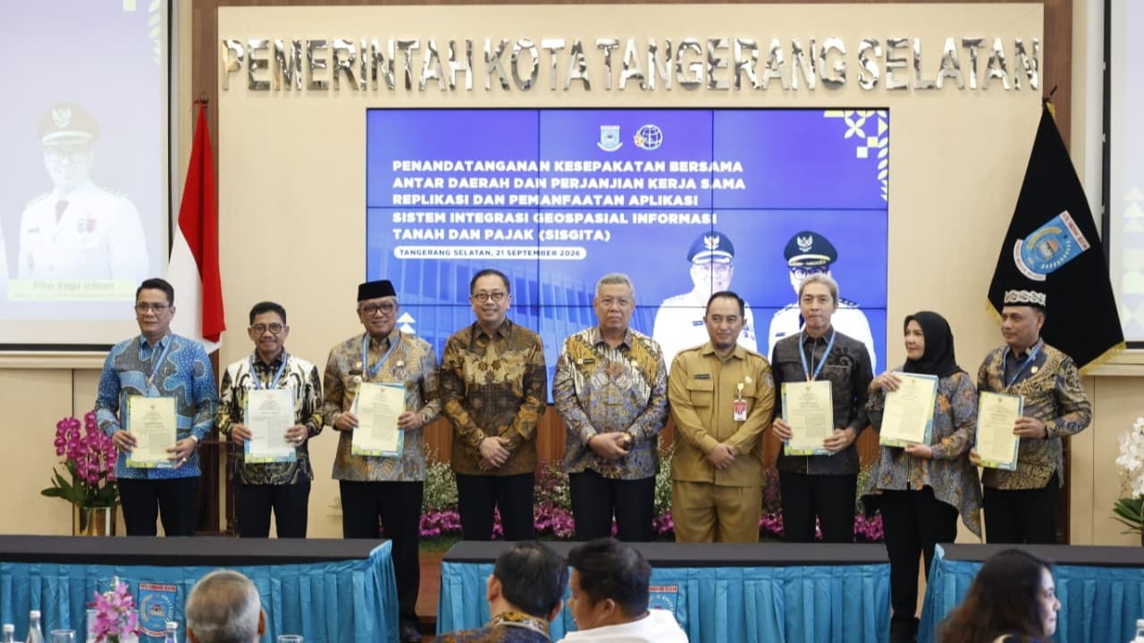
South Tangerang, September 21, 2026 – Representatives from 60 local governments—including 46 regional heads attending in person—gathered at Blandongan Hall, South Tangerang City Hall, to sign an agreement to replicate and strengthen the implementation of the Geospatial Information Integration System for Tax and Land (SISGITA). This inter-regional synergy has produced two key legal instruments: a Memorandum of Understanding (MoU) between regional heads and a technical cooperation agreement between the Regional Revenue Agency (Bapenda) and local Land Offices. This initiative paves the way for local governments across the country to adopt and adapt South Tangerang’s digital innovation to suit their respective fiscal capacities and regional characteristics.
The primary strength of SISGITA lies in its ability to integrate Bapenda’s tax object maps with the Land Office’s master land parcel maps in real time. This integration resolves the long-standing issue of data discrepancies between land and tax records—often caused by parcel subdivision, inheritance distribution, or ownership transfers that had not yet been updated in the Tax Due Notification Letter (SPPT). With this system, data mismatches are automatically detected with up to 99 percent accuracy; consequently, updating taxpayer names or adjusting parcel area measurements no longer relies on passive public initiative but is instead handled directly by a dedicated cross-agency task force.
This collaborative move has been welcomed by the Ministry of Home Affairs and the Ministry of Agrarian Affairs and Spatial Planning/National Land Agency (ATR/BPN) as a concrete solution to resolve land data issues that have previously hindered the optimization of the Land and Building Rights Acquisition Duty (BPHTB) and the Rural and Urban Land and Building Tax (PBB-P2). Strong interest from various regions—such as Tanggamus Regency, which seeks to analyze the management of its fiscal potential—demonstrates the cross-regional relevance of this spatial-based governance model. Furthermore, the South Tangerang City Government is currently preparing to upgrade SISGITA to a three-dimensional (3D) modeling format to map building footprints and volumes. This move underscores a commitment to digital transformation that not only boosts Locally-Generated Revenue (PAD) but also ensures fair and accurate public access to information.
On this occasion, Memorandums of Understanding (MoU) and Cooperation Agreements (PKS) were established between South Tangerang and 47 regencies and 12 cities, including APEKSI member cities: Bandar Lampung, Banjar, Banjarmasin, Bekasi, Bitung, Bogor, Kendari, Kotamobagu, Metro, Parepare, Tangerang, and Tomohon.
About SISGITA
The South Tangerang City Government has introduced a digital breakthrough known as the Geospatial Integration System for Land and Tax Information (SISGITA/SIGITA). This innovation, based on Geographic Information System (GIS) technology, integrates the spatial land parcel database from the Ministry of Agrarian Affairs and Spatial Planning/National Land Agency (ATR/BPN) with local tax data from the Regional Revenue Agency (Bapenda).
By matching Land Parcel Identification Numbers (NIB) with Land and Building Tax (PBB-P2) Tax Object Numbers (NOP) and accelerating the validation of the Duty on the Acquisition of Rights on Land and Building (BPHTB), the system can precisely map ownership and tax obligations, minimize potential data disputes, and optimize local revenue collection.